Agricultural Soils Report
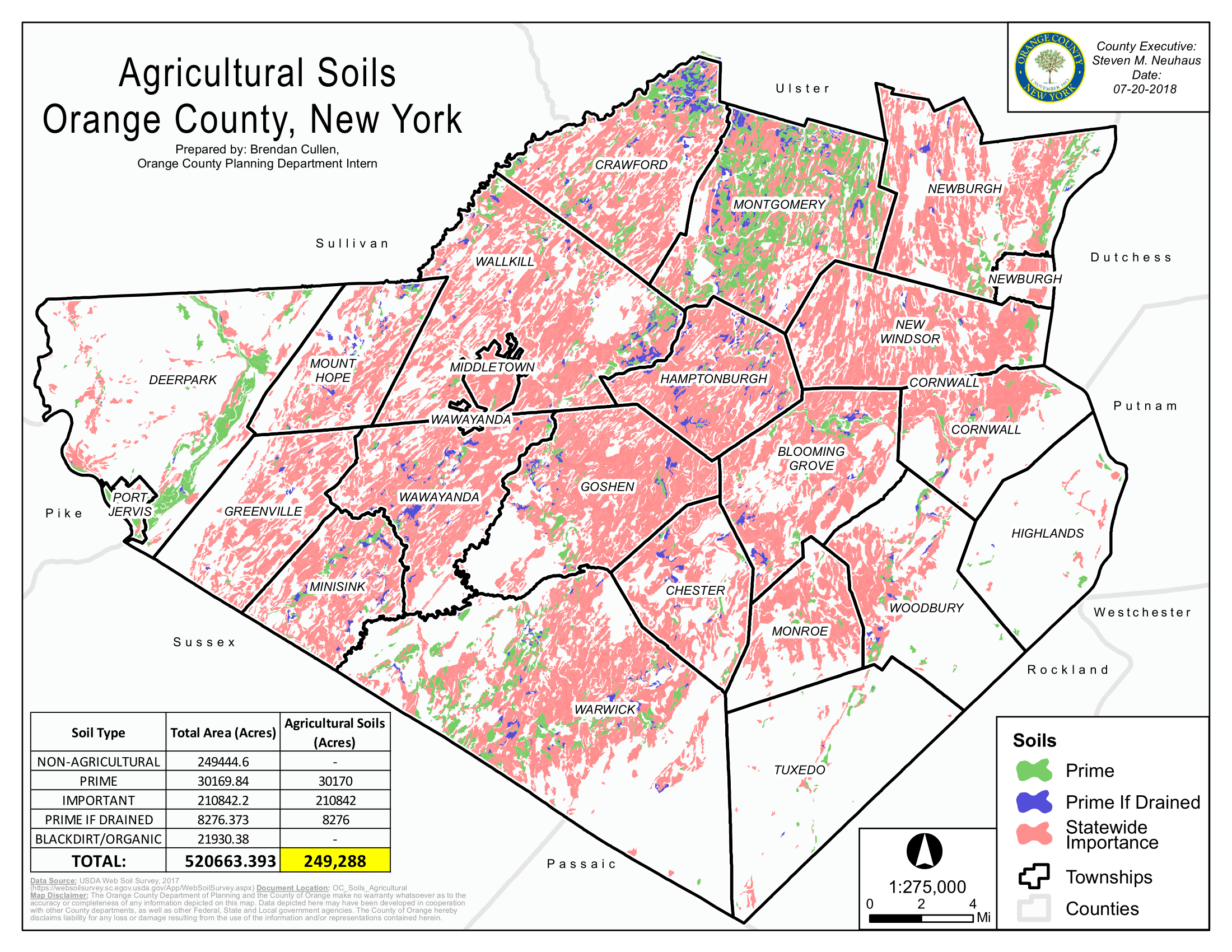
Orange County Agricultural Soils Map produced for an Orange County Agricultural Report. Map created using ArcMap.
I am a geospatial professional who regularly utilizes GIS, Python, and Javascript to manage, analyze, and visualize data. I have always loved maps, technology, and uniquness of place.

