
Cartography


Ursa Platform — At Ursa, I am one of the core developers of the Ursa Platform, a web-based satellite imagery tasking, ordering, and analytics user interface. We use Angular, Mapbox GL, and Stripe, in combination with Ursa’s Backend ...

Hurricane Ida Change Detection Dashboard — Produced for Ursa Space Systems. Developed using ArcGIS Online. Dashboard displays Ursa’s SAR-based Change Detection. Read More ...
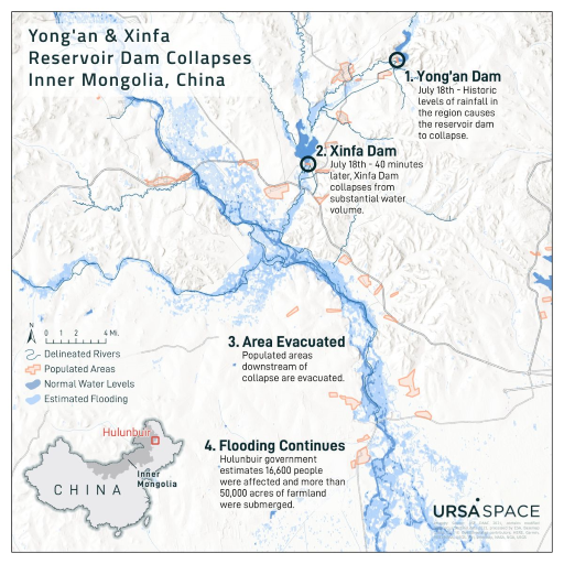
Inner Mongolia Dam Collapses — Produced for Ursa Space Systems. Designed using ArcGIS Pro. Map depicts the a SAR-based flood analysis after two reservoir dams collapsed in Hulubuir, China. Read More ...
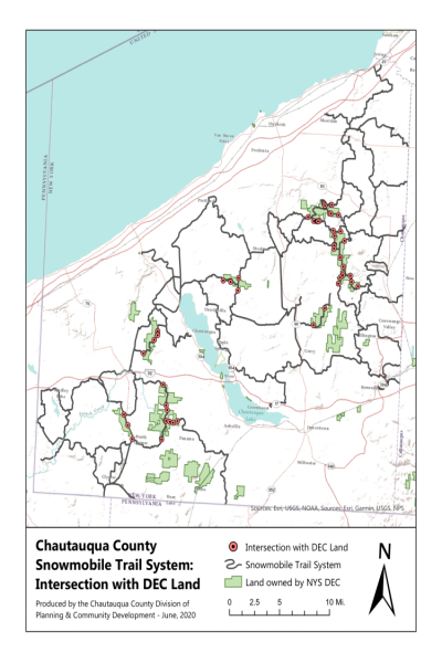
Chautauqua County Snowmobile Trail System: Intersection with DEC Land — Chautauqua County has over 400 miles of state-funded snowmobile trails. The New York Snowmobile Trail Grant Program provides funds to local governmental sponsors that engage in the development and maintenance of snowmobile trails designated as ...
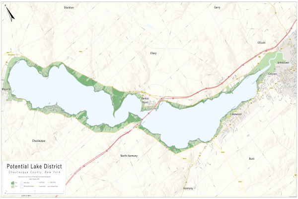
Potential Lake District — In 2018, Chautauqua County’s Legislature appointed a group of local elected officials to explore forming a Lake Protection and Rehabilitation District. The Chautauqua Lake Protection and Rehabilitation Agency was tasked with evaluating needs and making ...
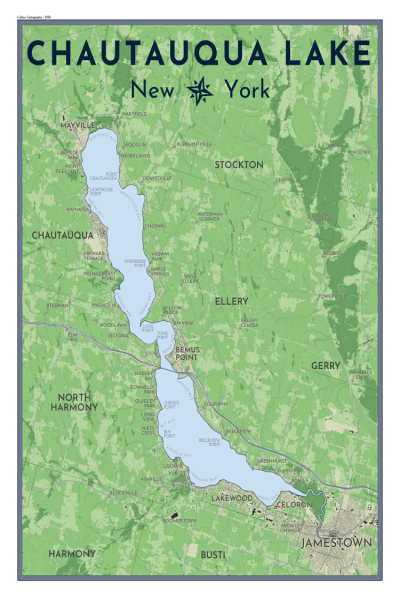
Chautauqua Lake, New York — Personal Project. Map depicts the communities and land cover of Chautauqua Lake, NY. Made using QGIS. ...
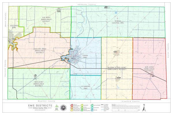
EMS Districts: Seneca County, OH — Reference map displaying updated EMS Districts of Seneca County, Ohio. Produced for the Seneca County Emergency Management Association. Created using ArcGIS Pro. ...
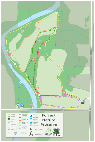
Parks & Nature Preserves: Seneca County, Ohio — A series of 11 maps displaying updated park boundaries and trails. The trails were created using GPS points collected in the field and georeferenced old park maps. Produced for the Seneca County Park District’s new ...
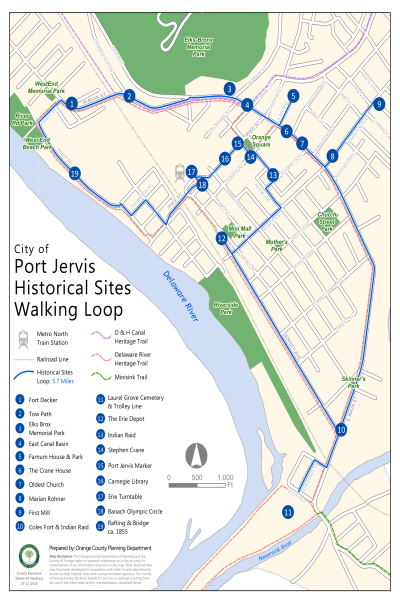
Port Jervis Historical Sites Walking Loop — Produced for the Orange County Planning Department in coordination with the Port Jervis Historical Society. Historical sites dataset created using GPS points collected in the field. Map created using ArcMap Network Analyst Extension. ...
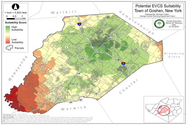
Electric Vehicle Charging Station Suitability Analysis — Suitability Analysis of Potential Electric Vehicle Charging Stations. Series of 6 maps created for various municipalities within Orange County. Produced for the Orange County Transportation Council. Analysis was performed using ArcMap, ModelBuilder, and Python. ...
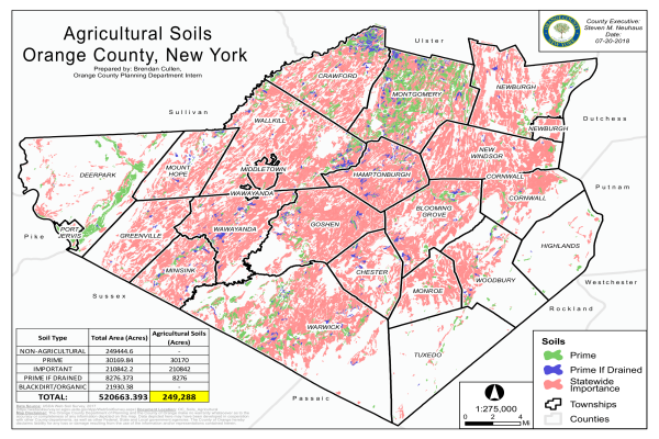
Agricultural Soils Report — Orange County Agricultural Soils Map produced for an Orange County Agricultural Report. Map created using ArcMap. ...
Load More