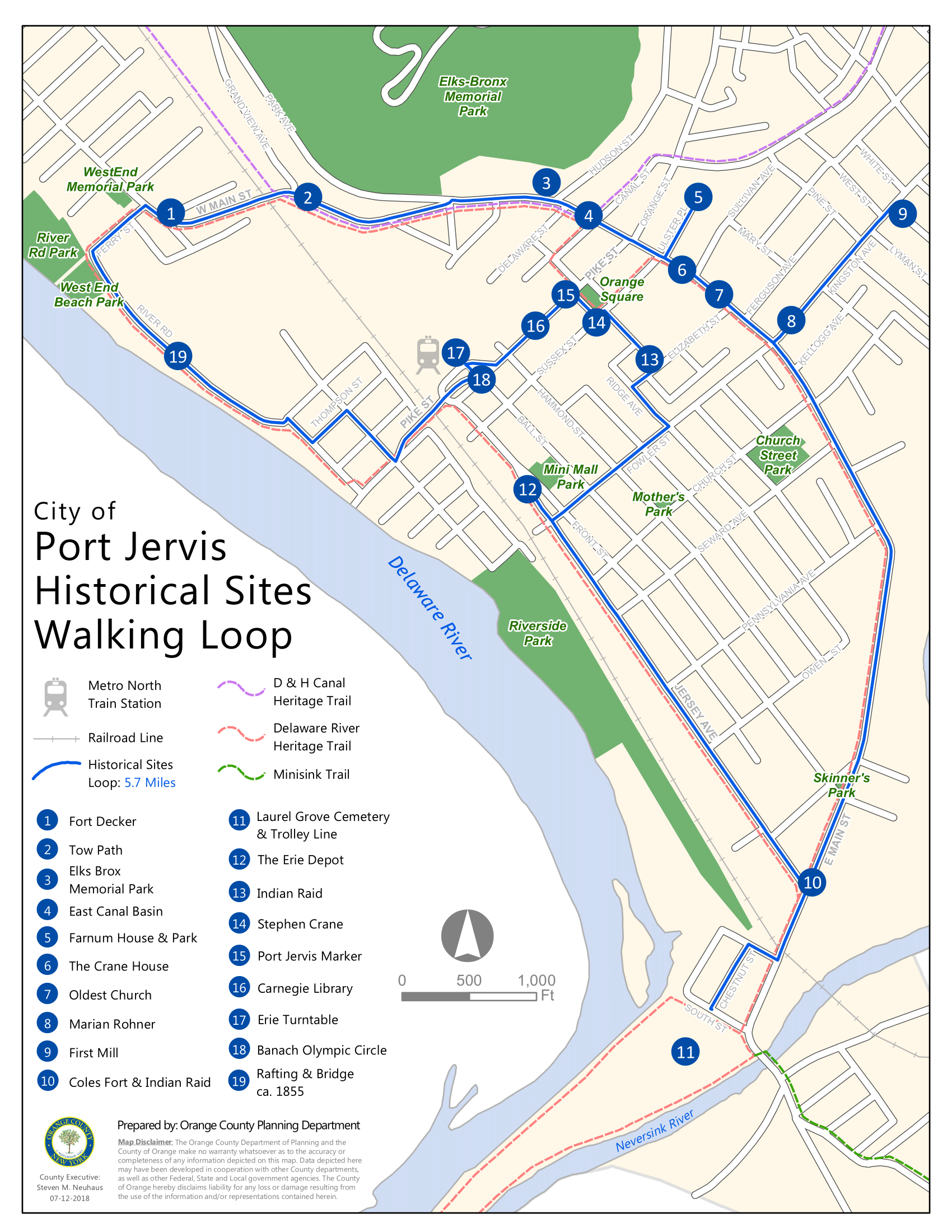
Port Jervis Historical Sites Walking Loop

Produced for the Orange County Planning Department in coordination with the Port Jervis Historical Society. Historical sites dataset created using GPS points collected in the field. Map created using ArcMap Network Analyst Extension.
I am a geospatial professional who regularly utilizes GIS, Python, and Javascript to manage, analyze, and visualize data. I have always loved maps, technology, and uniquness of place.


