Inner Mongolia Dam Collapses
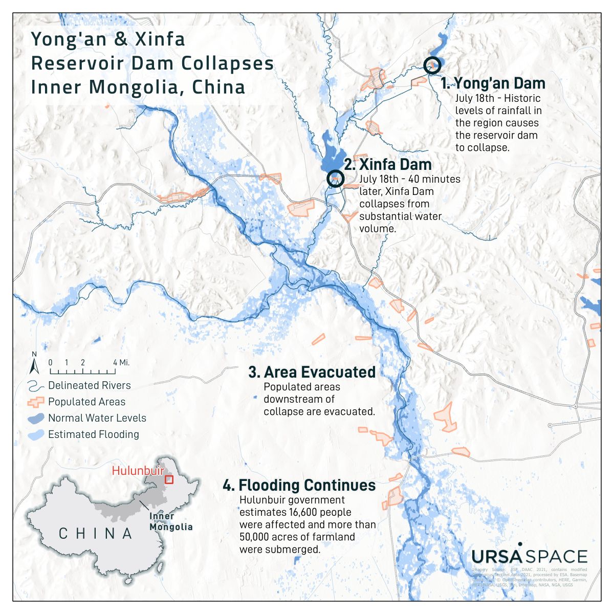
Produced for Ursa Space Systems. Designed using ArcGIS Pro. Map depicts the a SAR-based flood analysis after two reservoir dams collapsed in Hulubuir, China.
I am a geospatial professional who regularly utilizes GIS, Python, and Javascript to manage, analyze, and visualize data. I have always loved maps, technology, and uniquness of place.

